

Explore Trails
Download Map of current trail systems with links
We're thrilled to present our Saratoga County-wide trails Vision Map, designed by our friends at Byer Planning, designed to guide your outdoor adventures and show you STA's vision for the future of trail connections across Saratoga County!
This map is a living document, and we're eager to make it as complete and user-friendly as possible. Currently, you can download a PDF with links to more information on each trail system. If you notice any trails, parks, open spaces, or connectors missing, please do not hesitate to inform us using the feedback form at the bottom of this page. Insights from the community are invaluable to us.
Looking ahead, we're excited about the upcoming enhancements to this map's interactivity. Soon, you'll have the ability to click on each trail system for detailed maps of individual trails, check current trail conditions, understand the permitted trail user groups, and learn about the ownership and stewardship of these trails. Stay tuned for updates as we continue to evolve this page, making it an indispensable resource for all your trail exploration needs in Saratoga County!
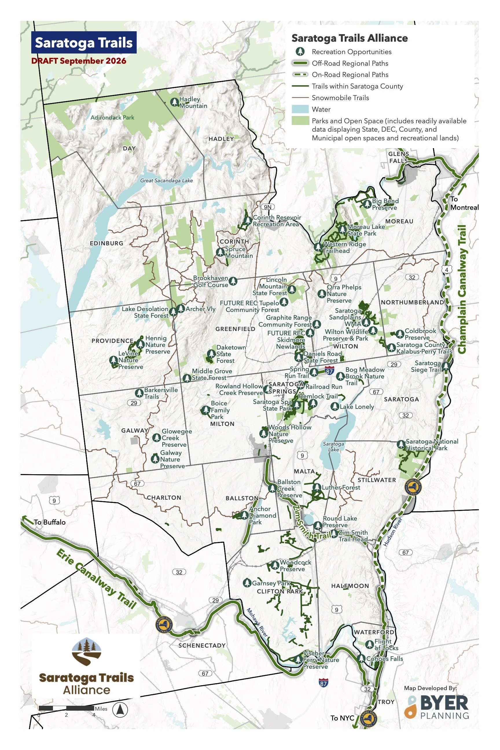
Current trail systems

STA Vision
In addition to advocating for and supporting major county-wide connections, we aim to help connect Saratoga County with our neighboring counties. With that in mind, we teamed up with Adirondack Cycling Advocates to document potential connections across the Hudson to connect our developing Saratoga trail system with the Feeder Canal Trail and Warren County Bike Trail. Stay tuned as we update this map with potential river crossings as we become aware of them!
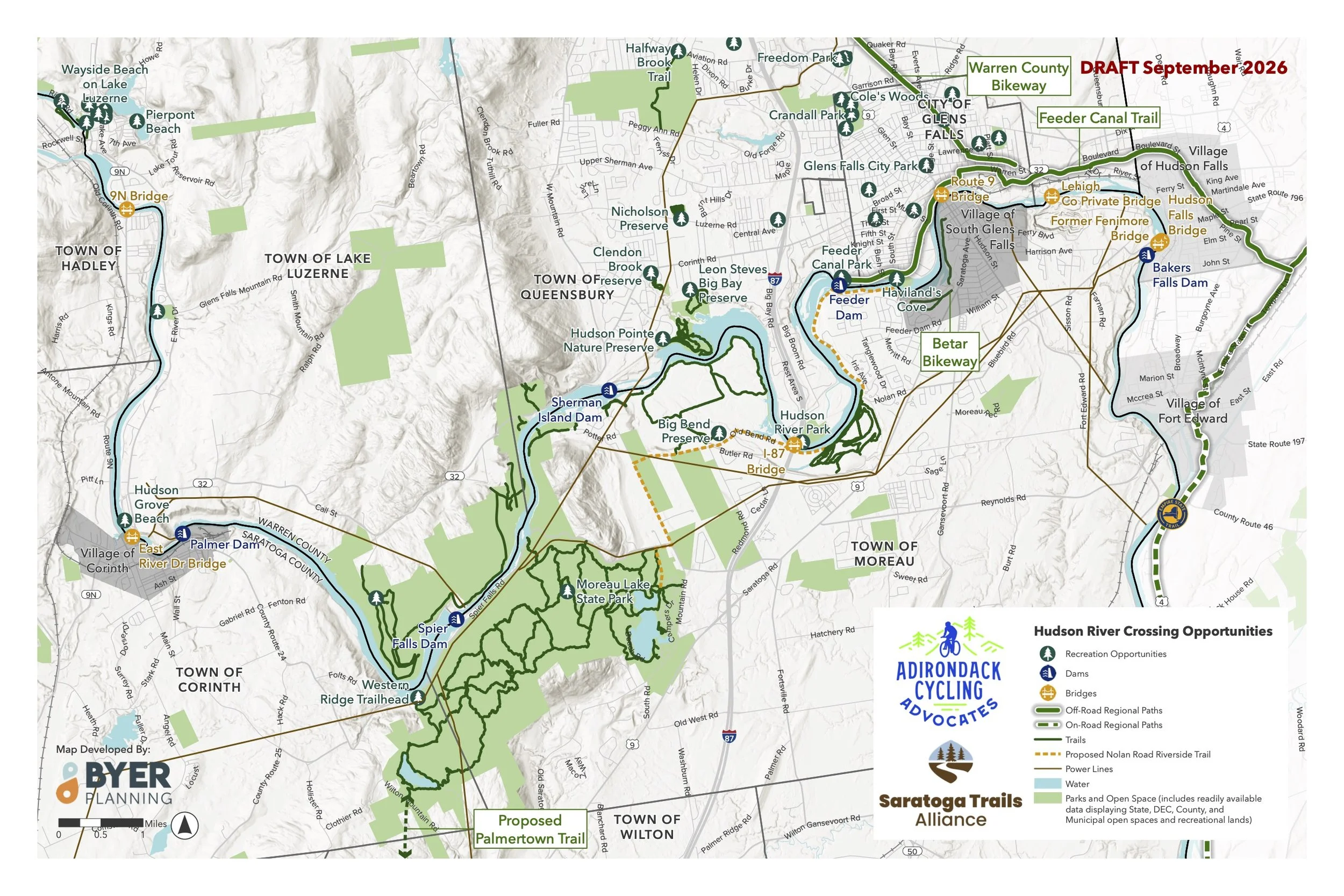
We welcome your insights and feedback – if you have any suggestions for current or proposed trails we are missing on our map, or any other aspects of STA, please share your thoughts with us here.